Restoring Coldstream Canyon
Coldstream Canyon, located just west of the Town of Truckee, is a mecca for recreational users including backpackers, mountain bikers, and bird watchers. However, this ecosystem is in danger of being lost forever. The canyon, which drains over 12 miles of rugged land surrounding Cold Creek has been degraded through historical logging, road construction, and gravel mining practices.
In partnership with California State Parks and other landowners, the Truckee River Watershed Council (TRWC) is now in the process of re-creating historical wetland habitat in areas impacted by gravel mining, improving drainage on improperly constructed roadways, and reestablishing the natural functions of the watershed.
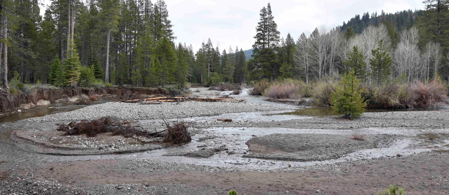
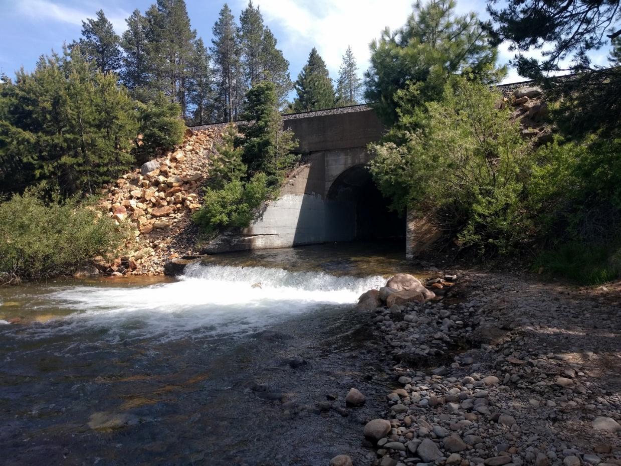
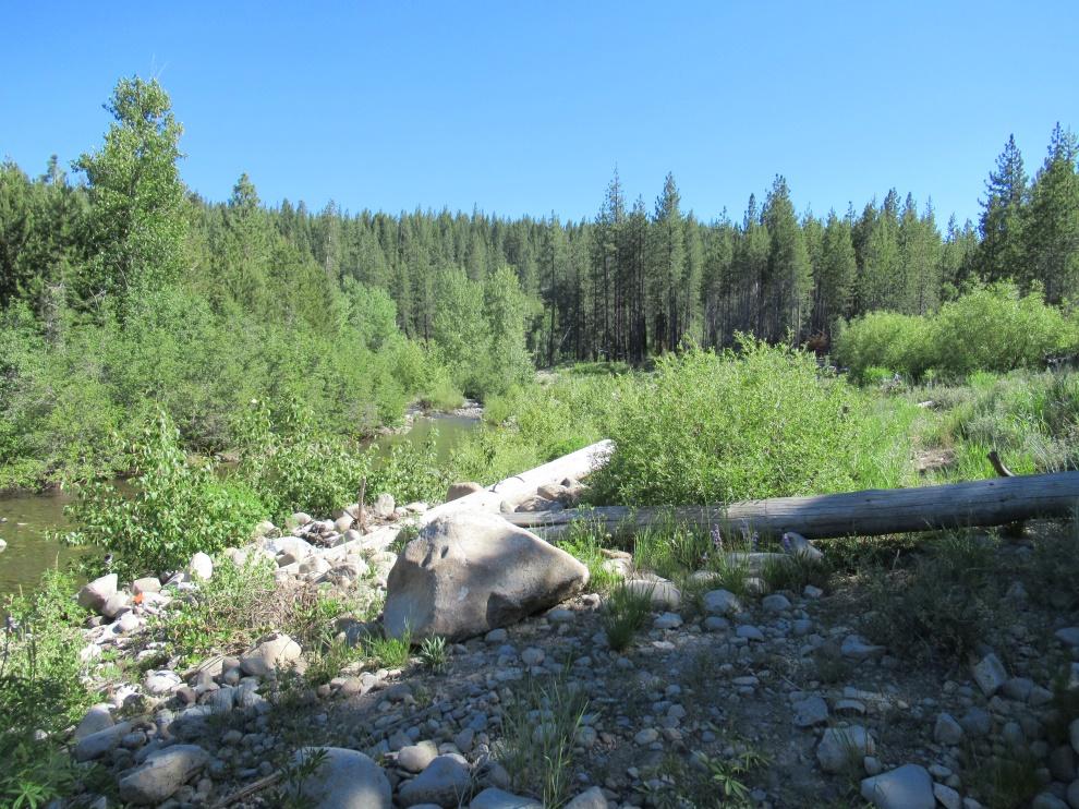
To restore this canyon, we have restored over 2,500 feet of stream channel and re-connected floodplain areas to help enhance riparian habitat and reduce erosion. The primary waterbody, Cold Creek is bound by the main east/west railroad line and is constricted by a giant culvert formed over the creek during railroad construction. This constriction caused what was once a dynamic alluvial fan to pulse tremendous amounts of sediment downstream during high flow events, degrading riparian habitat and causing heavy erosion along the streambanks. To re-establish a slower, more meandering flowpath and reduce excess sediment and erosion, TRWC restored the habitat downstream of the culvert, removing excess fill material and re-introducing appropriate riparian vegetation to the area.
2026 Lower Floodplain Restoration
We are continuing our work restoring Coldstream Canyon and Cold Creek to improve habitat, increase downstream water quality, and prevent excess erosion and futher degredation. TRWC restoration in this area – which will take place over Summer 2026 – will re-establish riparian habitat and allow natural systems to return to filtering out excess sediment and other pollutants.
To learn more and stay up-to-date on TRWC projects like this one, subscribe to our E-Newsletter.
2021 – 2026: Cold Creek Instream Restoration & Roads
Transforming the Health and Resiliency of our Watershed
50 acres of stream channel and riparian floodplain restored.
Restoring a one-mile reach of Cold Creek will reconnect the floodplain, increase groundwater retention table, and allow for riparian habitat to reestablish
Creating wetland habitat
12 acres of wetland habitat will either be enhanced or created.
Removing fill material placed from gravel mining activities will increase groundwater levels and will support wetland vegetation such as sedges, rushes and willows. This increase of habitat will help one of our most threatened ecosystems – local wetland habitat.
Restoring natural drainage patterns
13 miles of dirt road drainage improved.
Allowing water to flow along its natural path, rather than along dirt roads, helps to reduce extensive erosion and reconnects the natural hydrology of the watershed that was present prior to road disruption.
Where it
all happens
Fast Facts
Location: 1 mile west of the town of Truckee off of Highway 80
Scale: 50 acres of degraded stream channel proposed for restoration
12 acres of wetland habitat proposed for restoration
13 miles of dirt roadway improved
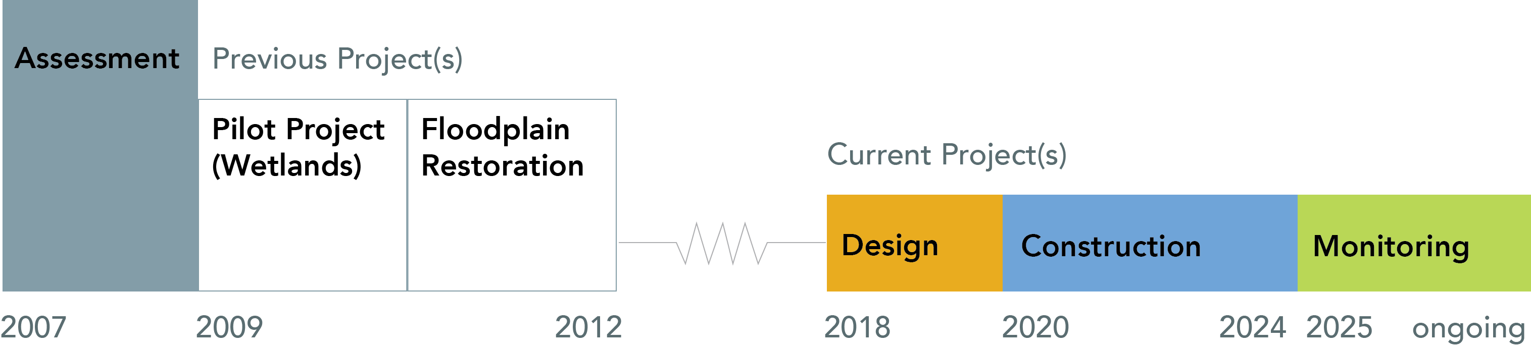
Scope: 2007 – 2025
Estimated Project Cost: $4 Million
Partially funded
Timeline